
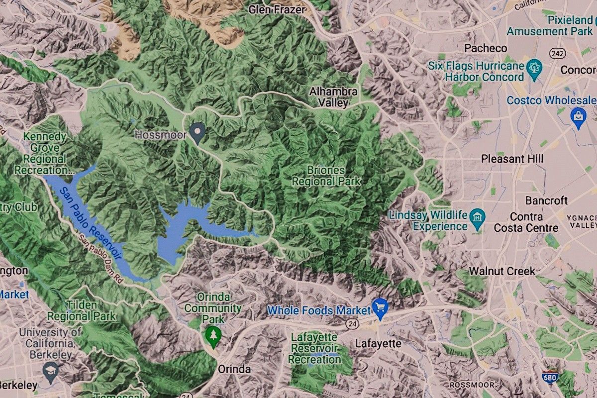
Map Terrain Features Quiz
 by Caitrin GoblePublished: July 22, 2026
Share


Maps are more than just navigational tools; they are windows into the diverse and intricate landscapes of our world. This quiz will take you on a virtual journey through various terrain features, challenging your ability to identify and understand them. Sharpen your geographical skills and see how well you know the earth’s topography!
We recommend that you do not leave the page that you are taking this quiz in. Stay honest 🙂
Map Terrain Features Quiz Questions Overview
1. What does a contour line on a topographic map represent?
A river
A road
Elevation
A boundary
2. Which symbol is commonly used to represent a mountain peak on a map?
A triangle
A circle
A square
A star
3. What is the term for a low area between hills or mountains, often with a river running through it?
Plateau
Valley
Cliff
Plain
4. On a map, what does the color blue typically represent?
Forests
Mountains
Water bodies
Deserts
5. Which terrain feature is represented by closely spaced contour lines?
Flat plain
Steep slope
Gentle hill
River valley
6. What is the term for a flat, elevated landform that rises sharply above the surrounding area?
Valley
Plateau
Canyon
Basin
7. What does a dashed line on a map typically indicate?
A major road
A river
A trail or footpath
A contour line
8. Which feature is represented by a V-shaped contour line pointing uphill?
Ridge
Valley
Cliff
Plateau
9. What is the term for a large, flat area of land that is higher than the surrounding land?
Mountain
Plain
Plateau
Hill
10. What does a green color on a map typically represent?
Water bodies
Forests or vegetation
Deserts
Urban areas
11. Which terrain feature is represented by widely spaced contour lines?
Steep slope
Flat plain
Mountain peak
River valley
12. What is the term for a narrow strip of land that connects two larger landmasses?
Isthmus
Peninsula
Delta
Archipelago
13. Which feature is represented by a U-shaped contour line pointing downhill?
Ridge
Valley
Cliff
Plateau
14. What does a red color on a map typically represent?
Water bodies
Forests
Urban areas or major roads
Deserts
15. What is the term for a large, natural stream of water flowing in a channel to the sea, a lake, or another river?
Lake
River
Pond
Stream
16. Which terrain feature is represented by a series of concentric contour lines?
Valley
Mountain or hill
Plateau
Canyon
17. What does a brown color on a map typically represent?
Water bodies
Forests
Deserts or bare earth
Urban areas
18. What is the term for a landform that extends into a body of water and is surrounded by water on three sides?
Isthmus
Peninsula
Delta
Archipelago
19. Which feature is represented by a contour line that forms a closed loop with no other contour lines inside it?
Valley
Plateau
Peak or summit
Canyon
20. What does a black color on a map typically represent?
Water bodies
Forests
Urban areas or buildings
Deserts
We recommend that you do not leave the page that you are taking this quiz in. Stay honest 🙂
Can Your Friends Do Better Than You in This Quiz?
Share this quiz with your friends and compare results.


Was this page helpful?
More Popular Geography Quizzes:
-
 Top Quiz
Eurout Conference Quiz
-
 Top Quiz
World Countries Quiz
-
 Top Quiz
Continents and Oceans Quiz
-
 Top Quiz
Google Earth Day Quiz
-
 Top Quiz
Earth Quiz
-
 Top Quiz
History Map Quiz
More Interesting Quizzes For You:
-
 Top Quiz
BMW Quiz
-
 Top Quiz
Seven Deadly Sins Quiz
-
 Top Quiz
Spelling Test Quiz
-
 Top Quiz
Water Quiz
-
 Top Quiz
Elements of Art Quiz
-
 Top Quiz
SAT Score Quiz